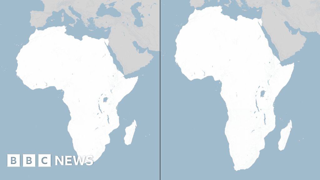
The resolution, sponsored by Togo and backed by African Union member states, was approved on Friday with 164 countries voting in favour, one against and six abstaining. The United States was the only country to vote against the resolution.
The initiative promotes the Equal Earth projection, a map design developed in 2018 that provides a more accurate representation of the relative areas of continents. It is intended to reduce the distortions associated with the Mercator projection, which has been widely used since the 16th century.
Under the Mercator projection, regions closer to the North and South Poles appear much larger than they actually are. For example, Greenland can appear roughly comparable in size to Africa, even though Africa is about 14 times larger than Greenland in land area.
Supporters of the resolution, including African governments and advocacy groups behind the “Correct the Map” campaign, argue that the longstanding visual distortion has contributed to inaccurate perceptions of Africa's geographical size and global significance.
However, the UN resolution does not ban the Mercator map or force countries to stop using it. Instead, it encourages governments, educational institutions and other organisations to consider the Equal Earth projection and other equal-area maps where accurate representation of land size is important.
The decision marks a significant symbolic victory for the African-led campaign and could influence the maps used in schools, textbooks, media, digital platforms and other educational materials around the world.